I went out on my bike yesterday to try to locate more of that victorian industrial infrastructure that I so love. I failed. But I did come across lots of other things.
My intention was to go to Whitecross to see if anything remained of the Manuel Lower Train Station (there isn't), so I took the route through Grangemouth and Old Polmont, skirting round Polmont itself, up the Nicolton Road to Lathallan. The entrance to the Lathallan Estate from the Nicolton Road is now gated off, which is a shame, but still I somehow found myself on the other side of that gate with a tear in my shorts, so onward ho!
Lathallan House must have been gorgeous in it's day, and would have certainly have been a place that oiks like me would have been hunted away with sticks and the like. But now under 'right to roam' I can explore. There are plenty of other images of Lathallan out there but here are mine.


Lathallan is for sale if somebody wants to do something with it, but I think it is out of my range. On the estate there is also an Walled Orchard, but I somehow contrived to go down a track I thought would take me there, but didn't [another trip I think ...].
I took the path that linked up to the old Haining Road which took me south to the railway line, where there is a bridge, in the middle of nowhere, and I guess used by very few.


This brings you to the Haining Wood, which although nice, is simply no place for a bike, so I continued up to the the Industrial Estate on the site of the old Manuel Brickworks, and to my complete surprise it is all gone ... well except the floor and the roads. All the buildings have been removed, well except the one that the brickworks stopped people getting a close look at Almond Castle.


Again there are plenty of pictures out there on the web [including ones taken inside by somestupid brave kids] but these are mine.
I was able to cross the now empty estate to Whitecross, which is ... Whitecross, I mean, it is in Falkirk District, and Stirlingshire, but closer to Linlithgow, but still so far from either that it sort of falls between the two, given that it is not on a major road. I suppose most people here choose it because it is out of the way, but still gives you easy access to Central Scotland, hey, not for me.
As soon as you get to the Eastern side of Whitecross you can see the former railway line, which was Slamannan to Bo'ness line by the trees in a straight line that nearly always mean railway line.

But that was that, I followed the old map, down Station Road, then up the lane, which still exists, to well, not much.

Compared to an old picture taken in roughly the same place, there is nothing (I suppose I will have to return when winter has killed the foliage).

Deflated by this, I started heading for Kinneil, because from there the route home was flat, and I had done enough hills, which is when I really got sidetracked, I followed the path to the Linlithgow Road, then passed under the motorway, when I saw the sign "River Avon Heritage Trail to Avonbank Community Woodland". Aha, these I normally love. But I found rather dull. Better described as a bit of land between the M9 and the River Avon with a mucky path in and a mucky path out.
I took a picture of an old mill in Linlithgow, from Falkirk.

And a picture of the M9 from an angle that is rarely seen.

But getting out of the woodland, pushing my bike up a mucky path up a hill, so wore it out of me that I gave up on Kinneil and turned for home. Linlithgow Road - Polmonthill - back through Grangemouth and home.
My intention was to go to Whitecross to see if anything remained of the Manuel Lower Train Station (there isn't), so I took the route through Grangemouth and Old Polmont, skirting round Polmont itself, up the Nicolton Road to Lathallan. The entrance to the Lathallan Estate from the Nicolton Road is now gated off, which is a shame, but still I somehow found myself on the other side of that gate with a tear in my shorts, so onward ho!
Lathallan House must have been gorgeous in it's day, and would have certainly have been a place that oiks like me would have been hunted away with sticks and the like. But now under 'right to roam' I can explore. There are plenty of other images of Lathallan out there but here are mine.


Lathallan is for sale if somebody wants to do something with it, but I think it is out of my range. On the estate there is also an Walled Orchard, but I somehow contrived to go down a track I thought would take me there, but didn't [another trip I think ...].
I took the path that linked up to the old Haining Road which took me south to the railway line, where there is a bridge, in the middle of nowhere, and I guess used by very few.


This brings you to the Haining Wood, which although nice, is simply no place for a bike, so I continued up to the the Industrial Estate on the site of the old Manuel Brickworks, and to my complete surprise it is all gone ... well except the floor and the roads. All the buildings have been removed, well except the one that the brickworks stopped people getting a close look at Almond Castle.


Again there are plenty of pictures out there on the web [including ones taken inside by some
I was able to cross the now empty estate to Whitecross, which is ... Whitecross, I mean, it is in Falkirk District, and Stirlingshire, but closer to Linlithgow, but still so far from either that it sort of falls between the two, given that it is not on a major road. I suppose most people here choose it because it is out of the way, but still gives you easy access to Central Scotland, hey, not for me.
As soon as you get to the Eastern side of Whitecross you can see the former railway line, which was Slamannan to Bo'ness line by the trees in a straight line that nearly always mean railway line.
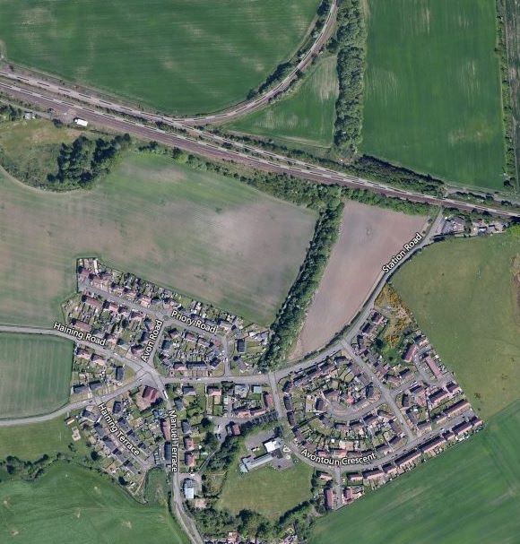
But that was that, I followed the old map, down Station Road, then up the lane, which still exists, to well, not much.

Compared to an old picture taken in roughly the same place, there is nothing (I suppose I will have to return when winter has killed the foliage).

Deflated by this, I started heading for Kinneil, because from there the route home was flat, and I had done enough hills, which is when I really got sidetracked, I followed the path to the Linlithgow Road, then passed under the motorway, when I saw the sign "River Avon Heritage Trail to Avonbank Community Woodland". Aha, these I normally love. But I found rather dull. Better described as a bit of land between the M9 and the River Avon with a mucky path in and a mucky path out.
I took a picture of an old mill in Linlithgow, from Falkirk.

And a picture of the M9 from an angle that is rarely seen.

But getting out of the woodland, pushing my bike up a mucky path up a hill, so wore it out of me that I gave up on Kinneil and turned for home. Linlithgow Road - Polmonthill - back through Grangemouth and home.
Comments
Post a Comment